Category:Frisby on the Wreake
Jump to navigation
Jump to search
Main Wikipedia article: Frisby on the Wreake.

village in the United Kingdom  | |||||
| Upload media | |||||
| Instance of | |||||
|---|---|---|---|---|---|
| Location | Melton, Leicestershire, East Midlands, England | ||||
| official website | |||||
 | |||||
Subcategories
This category has the following 2 subcategories, out of 2 total.
Media in category "Frisby on the Wreake"
The following 200 files are in this category, out of 289 total.
(previous page) (next page)-

-
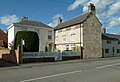
 "The Bell Inn", Frisby on the Wreake - geograph.org.uk - 3931845.jpg 2,472 × 1,766; 1.19 MB
-
 3 Main Street Frisby on the Wreake - geograph.org.uk - 4462751.jpg 1,280 × 890; 306 KB
-
 A corner on Gaddesby Lane - geograph.org.uk - 4931621.jpg 640 × 494; 111 KB
-
 A tributary of Rearsby Brook - geograph.org.uk - 6319504.jpg 1,637 × 1,128; 415 KB
-
 A607 heading towards Leicester - geograph.org.uk - 3055403.jpg 3,257 × 2,243; 2.78 MB
-
 A607 near to Frisby on the Wreake - geograph.org.uk - 146637.jpg 640 × 431; 60 KB
-
 A607 towards Melton Mowbray - geograph.org.uk - 3055394.jpg 2,675 × 2,226; 2.25 MB
-
 Access notice for pylon - geograph.org.uk - 4931629.jpg 640 × 560; 121 KB
-
 Across the fields to Hickory Lodge Farm - geograph.org.uk - 3054401.jpg 2,231 × 1,897; 1.68 MB
-

-
 Benchmark on St Thomas of Canterbury Church - geograph.org.uk - 3977389.jpg 683 × 1,024; 263 KB
-
 Benchmark on trig point near Frisby Lodge - geograph.org.uk - 3977435.jpg 683 × 1,024; 221 KB
-
 Bend in Gaddesby Lane - geograph.org.uk - 2810428.jpg 640 × 446; 120 KB
-
 Bends on the A607 - geograph.org.uk - 2000458.jpg 640 × 421; 77 KB
-
 Blue Bell Inn Frisby.jpg 3,440 × 2,444; 3.19 MB
-
 Bridge over former lock at Mill Deeping - geograph.org.uk - 5180915.jpg 640 × 480; 137 KB
-

-
 British Telecom cover - geograph.org.uk - 5555357.jpg 640 × 396; 152 KB
-
 Brockleys Farm, Thorpe Satchville Road - geograph.org.uk - 144477.jpg 640 × 427; 105 KB
-
 Bus stops along the A607 - geograph.org.uk - 3055399.jpg 3,230 × 2,425; 3.02 MB
-

-

-

-

-

-

-

-

-

-

-
 Club house - geograph.org.uk - 146649.jpg 640 × 480; 83 KB
-
 Cottages off Main Street, Frisby on the Wreake - geograph.org.uk - 4462774.jpg 1,280 × 960; 314 KB
-
 Cows along the Leicestershire Round Footpath - geograph.org.uk - 3057834.jpg 1,920 × 1,452; 1.24 MB
-
 Cows and crops near Elms Cottages Farm - geograph.org.uk - 3058341.jpg 3,264 × 2,448; 3.13 MB
-
 Cows near The Elms Farm - geograph.org.uk - 3057828.jpg 1,895 × 1,375; 1,013 KB
-
 Cricket Pavilion - geograph.org.uk - 5347466.jpg 3,648 × 2,736; 2.55 MB
-
 Crop field off Leicester Road - geograph.org.uk - 3041876.jpg 640 × 480; 71 KB
-
 Crop spraying - geograph.org.uk - 144416.jpg 640 × 427; 126 KB
-
 Crops along the Leicestershire Round Footpath - geograph.org.uk - 3058621.jpg 2,448 × 3,264; 3.32 MB
-
 Cross, Frisby on the Wreake - geograph.org.uk - 4455648.jpg 1,199 × 1,754; 258 KB
-
 D200 Frisby on the Wreake.jpg 1,798 × 1,236; 370 KB
-
-

-
-

-
 Double gated field entrance - geograph.org.uk - 2815250.jpg 640 × 447; 121 KB
-
 Electricity pylon at Bran Hills - geograph.org.uk - 3054437.jpg 3,016 × 2,283; 2.75 MB
-
 Eleven electricity pylons - geograph.org.uk - 3054419.jpg 2,752 × 2,107; 2.21 MB
-
 Elms Cottages - geograph.org.uk - 2810429.jpg 640 × 474; 55 KB
-
 Elms Cottages - geograph.org.uk - 3051875.jpg 2,964 × 2,190; 2.6 MB
-
 Entrance - geograph.org.uk - 2815251.jpg 640 × 468; 59 KB
-
 Entrance to Mill Deeping - geograph.org.uk - 5180919.jpg 640 × 464; 118 KB
-
 Entrance to Mill Deeping - geograph.org.uk - 5180920.jpg 640 × 455; 110 KB
-
 Farm track at Bran Hills - geograph.org.uk - 3054483.jpg 2,443 × 2,740; 2.89 MB
-
 Farm track off Gaddesby Lane - geograph.org.uk - 144469.jpg 600 × 450; 62 KB
-
 Farm track off Leicester Road - geograph.org.uk - 3041874.jpg 480 × 640; 95 KB
-
 Farmland and pylon near Asfordby - geograph.org.uk - 3038571.jpg 640 × 427; 38 KB
-
 Farmland in the Wreake Valley - geograph.org.uk - 4427890.jpg 640 × 426; 45 KB
-
 Farmland near Bran Hills - geograph.org.uk - 3054475.jpg 2,519 × 2,028; 1.89 MB
-
 Farmland near Chalk Pool Hill - geograph.org.uk - 3159804.jpg 3,085 × 2,050; 2.25 MB
-
 Farmland near Frisby Grange - geograph.org.uk - 3055714.jpg 2,830 × 2,239; 2.62 MB
-
 Farmland near Frisby on the Wreake - geograph.org.uk - 3038575.jpg 640 × 520; 102 KB
-
 Farmland near The Elms Farm - geograph.org.uk - 3058600.jpg 2,922 × 2,270; 2.05 MB
-
 Farmland near The Elms Farm - geograph.org.uk - 3058641.jpg 2,350 × 1,843; 1.95 MB
-
 Farmland near the Leicestershire Round Footpath - geograph.org.uk - 3058609.jpg 3,258 × 2,267; 3.31 MB
-
 Farmland off the A607 - geograph.org.uk - 3041890.jpg 640 × 529; 71 KB
-
 Farmland, Frisby on the Wreake - geograph.org.uk - 4431731.jpg 640 × 426; 58 KB
-
 Farmland, Frisby on the Wreake - geograph.org.uk - 4431736.jpg 640 × 426; 73 KB
-
 Farmland, Frisby on the Wreake - geograph.org.uk - 4431754.jpg 640 × 426; 60 KB
-
 Feeding the lambs - geograph.org.uk - 3057819.jpg 1,394 × 1,193; 794 KB
-
 Field and hedges east of Gaddesby Lane - geograph.org.uk - 5453466.jpg 640 × 486; 136 KB
-

-
 Fields by the A607 - geograph.org.uk - 2000459.jpg 640 × 480; 104 KB
-
 Fields by Washstones Lane - geograph.org.uk - 3349581.jpg 640 × 478; 75 KB
-
 Fields of crops near Cream Gorse - geograph.org.uk - 3058628.jpg 2,791 × 2,239; 2.27 MB
-
 Fields west of Gaddesby Lane - geograph.org.uk - 5555354.jpg 640 × 440; 83 KB
-
 Fingerpost, Water Lane, Frisby on the Wreake - geograph.org.uk - 4462736.jpg 960 × 1,280; 285 KB
-
 Fire Hydrant and Stop Valve marker posts - geograph.org.uk - 5555359.jpg 640 × 434; 157 KB
-
 Fire Hydrant cover - geograph.org.uk - 5555360.jpg 640 × 474; 170 KB
-

-
 Fishing and Sewage Works - geograph.org.uk - 3350064.jpg 640 × 471; 62 KB
-
 Flood on Mill Lane - geograph.org.uk - 6197231.jpg 640 × 457; 111 KB
-
 Footbridge along the Leicestershire Round Footpath - geograph.org.uk - 3055484.jpg 2,448 × 3,264; 3.31 MB
-
 Footbridge along the Leicestershire Round Footpath - geograph.org.uk - 3057839.jpg 2,039 × 2,273; 1.79 MB
-
 Footbridge along the Leicestershire Round Footpath - geograph.org.uk - 3057848.jpg 2,434 × 2,974; 3.06 MB
-

-
 Footpath through the crops - geograph.org.uk - 3055481.jpg 2,427 × 2,267; 2.18 MB
-
 Footpath to Asfordby - geograph.org.uk - 4931622.jpg 640 × 462; 101 KB
-
 Footpath to Asfordby - geograph.org.uk - 5180923.jpg 640 × 482; 139 KB
-
 Footpath to Frisby - geograph.org.uk - 146651.jpg 640 × 511; 88 KB
-
 Footpath to Frisby on the Wreake - geograph.org.uk - 3156914.jpg 2,448 × 3,264; 3.12 MB
-
 Footpath towards Frisby - geograph.org.uk - 3041880.jpg 480 × 640; 100 KB
-
 Former canal at Mill Deeping - geograph.org.uk - 5180925.jpg 640 × 505; 159 KB
-
 Former coaching inn (geograph 7459641).jpg 5,892 × 3,555; 7.03 MB
-
 Former lock at Mill Deeping - geograph.org.uk - 5180927.jpg 640 × 464; 137 KB
-
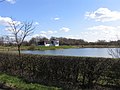
 Frisby Lakes - geograph.org.uk - 5180911.jpg 640 × 478; 61 KB
-
 Frisby level crossing - geograph.org.uk - 4462873.jpg 1,280 × 960; 318 KB
-
 Frisby level crossing - geograph.org.uk - 4462877.jpg 1,280 × 960; 286 KB
-

-
 Frisby on the Wreake Methodist Church - geograph.org.uk - 4462787.jpg 1,280 × 944; 268 KB
-
 Frisby on the Wreake Rail Signal Box.JPG 3,784 × 2,448; 3.3 MB
-
 Frisby on the Wreake, Great Lane - geograph.org.uk - 3156932.jpg 3,264 × 2,448; 3.63 MB
-
 Frisby on the Wreake, Great Lane - geograph.org.uk - 3156935.jpg 2,039 × 1,692; 1.24 MB
-
 Frisby on the Wreake, Great Lane - geograph.org.uk - 3156940.jpg 2,588 × 1,844; 2.08 MB
-
 Frisby on the Wreake, Mill Lane - geograph.org.uk - 3156927.jpg 1,955 × 1,925; 1.81 MB
-
 Frisby Signal Box - geograph.org.uk - 4462874.jpg 1,280 × 960; 282 KB
-
 Frisby signal box and level crossing - geograph.org.uk - 5180912.jpg 640 × 438; 75 KB
-
 Frisby station site geograph-3538801-by-Ben-Brooksbank.jpg 2,339 × 1,480; 2.42 MB
-
 Frisby Store. Main Street - geograph.org.uk - 4462777.jpg 1,280 × 947; 295 KB
-
 From Chalk Pool Hill - geograph.org.uk - 144445.jpg 640 × 427; 119 KB
-

-
 Gaddesby Lane - geograph.org.uk - 2815253.jpg 640 × 525; 91 KB
-
 Gaddesby Lane - geograph.org.uk - 3041895.jpg 640 × 435; 102 KB
-
 Gaddesby Lane - geograph.org.uk - 6002868.jpg 3,776 × 2,520; 3.35 MB
-
 Gaddesby Lane and Elm Cottages - geograph.org.uk - 4931623.jpg 640 × 432; 93 KB
-
 Gaddesby Lane away from Frisby - geograph.org.uk - 2815252.jpg 640 × 537; 123 KB
-
 Gaddesby Lane descends Bran Hills - geograph.org.uk - 3054452.jpg 2,260 × 2,253; 1.84 MB
-
 Gaddesby Lane heading towards Elms Cottages - geograph.org.uk - 3054266.jpg 2,667 × 1,987; 2.08 MB
-
 Gaddesby Lane heading towards Elms Cottages - geograph.org.uk - 3054287.jpg 3,264 × 2,448; 3.06 MB
-
 Gaddesby Lane heading towards The Elms - geograph.org.uk - 3054296.jpg 2,996 × 2,124; 2.31 MB
-
 Gaddesby Lane into Frisby - geograph.org.uk - 2815255.jpg 640 × 546; 80 KB
-
 Gaddesby Lane leading from Frisby on the Wreake - geograph.org.uk - 6055172.jpg 3,776 × 2,520; 4.25 MB
-

-
 Gaddesby Lane near to The Elms - geograph.org.uk - 4931624.jpg 640 × 429; 80 KB
-
 Gaddesby Lane passes Elm Cottages - geograph.org.uk - 5453276.jpg 640 × 503; 116 KB
-

-
 Gaddesby Lane towards Frisby - geograph.org.uk - 2804743.jpg 640 × 480; 98 KB
-
 Gaddesby Lane towards Frisby - geograph.org.uk - 4931634.jpg 640 × 488; 124 KB
-
 Gaddesby Lane towards Frisby - geograph.org.uk - 5453467.jpg 640 × 465; 115 KB
-
 Gaddesby Lane towards Frisby - geograph.org.uk - 5555355.jpg 640 × 450; 73 KB
-

-

-
 Gaddesby Lane towards Gaddesby - geograph.org.uk - 2804744.jpg 640 × 480; 70 KB
-
 Gaddesby Lane towards Gaddesby - geograph.org.uk - 4931630.jpg 640 × 471; 95 KB
-
 Gaddesby Lane towards Gaddesby - geograph.org.uk - 5453468.jpg 640 × 445; 99 KB
-
 Gaddesby Lane towards Gaddesby - geograph.org.uk - 5555356.jpg 640 × 455; 120 KB
-
 Gaddesby Lane towards Gaddesby - geograph.org.uk - 5555362.jpg 640 × 477; 115 KB
-

-
 Gaddesby Lane-Leicester Road junction - geograph.org.uk - 2815256.jpg 640 × 540; 117 KB
-
 Gate along the Leicestershire Round Footpath - geograph.org.uk - 3055411.jpg 3,264 × 2,448; 3.79 MB
-
 Gate along the Leicestershire Round Footpath - geograph.org.uk - 3055470.jpg 3,264 × 2,448; 3.15 MB
-
 Gate into a field east of Gaddesby Lane - geograph.org.uk - 2786406.jpg 640 × 523; 117 KB
-
 Gateway marked for temporary access - geograph.org.uk - 4931631.jpg 640 × 445; 76 KB
-
 Glebe Cottage, Church Lane, Frisby on the Wreake - geograph.org.uk - 4462791.jpg 1,280 × 960; 273 KB
-

-
 Grazing land towards Washstones Lane - geograph.org.uk - 3038577.jpg 640 × 485; 65 KB
-
 Grazing sheep near The Elms farm - geograph.org.uk - 3055732.jpg 1,824 × 1,122; 799 KB
-
 Great Lane Frisby on the Wreake 2012 - geograph.org.uk - 2823604.jpg 640 × 478; 109 KB
-
 Great Lane Leicester Road Junction - geograph.org.uk - 3350063.jpg 640 × 460; 44 KB
-

-
 Hall Orchard Lane from near the school - geograph.org.uk - 4931602.jpg 640 × 473; 116 KB
-
 Heading north along Gaddesby Lane - geograph.org.uk - 3054365.jpg 2,437 × 1,971; 2.22 MB
-
 Heading north along the Leicestershire Round Footpath - geograph.org.uk - 3055425.jpg 2,562 × 2,081; 2.43 MB
-
 Heading north on the Leicestershire Round Footpath - geograph.org.uk - 3058348.jpg 2,428 × 2,445; 2.31 MB
-
 Heading south along the Leicestershire Round Footpath - geograph.org.uk - 3055415.jpg 2,417 × 2,360; 2.49 MB
-
 Heading south on the Leicestershire Round Footpath - geograph.org.uk - 3057852.jpg 3,264 × 2,448; 3.09 MB
-
 Hedge and trees along the footpath - geograph.org.uk - 3058631.jpg 2,524 × 2,018; 1.95 MB
-
 Herd of cows along the Leicestershire Round Footpath - geograph.org.uk - 3057830.jpg 2,880 × 1,796; 2.35 MB
-
 Hickory Lodge - geograph.org.uk - 2815254.jpg 640 × 495; 77 KB
-
 Hoby Road near Frisby on the Wreake - geograph.org.uk - 1242322.jpg 640 × 392; 52 KB
-
 Hollow Lane, Frisby on the Wreake - geograph.org.uk - 4462794.jpg 1,280 × 960; 323 KB
-
 House on Well Field Lane - geograph.org.uk - 4431739.jpg 640 × 426; 40 KB
-
 Houses on Mill Lane - geograph.org.uk - 3349588.jpg 640 × 481; 51 KB
-
 Inquisitive little fella^ - geograph.org.uk - 3055743.jpg 854 × 691; 227 KB
-
 Junction of A607 and Gaddesby Lane - geograph.org.uk - 3055392.jpg 2,575 × 1,780; 1.81 MB
-

-

-
 Layby beside A607 Leicester Road - geograph.org.uk - 3977455.jpg 1,024 × 683; 147 KB
-

-

-
 Leicestershire Round Footpath - geograph.org.uk - 3055406.jpg 3,264 × 2,448; 3.14 MB
-
 Leicestershire Round Footpath - geograph.org.uk - 3055438.jpg 2,174 × 2,527; 2.5 MB
-
 Leicestershire Round Footpath - geograph.org.uk - 3055463.jpg 3,264 × 2,448; 3.85 MB
-
 Leicestershire Round Footpath - geograph.org.uk - 3055467.jpg 2,448 × 3,264; 2.97 MB
-

-

-

-
 Level crossing near Frisby on the Wreake - geograph.org.uk - 3156924.jpg 3,077 × 2,252; 2.61 MB
-
 Looking east towards Elms Cottages Farm - geograph.org.uk - 3058618.jpg 2,148 × 1,609; 1.16 MB
-
 Main Street - geograph.org.uk - 2970710.jpg 640 × 417; 51 KB
-
 Medieval cross, Frisby on the Wreake - geograph.org.uk - 4462739.jpg 960 × 1,280; 400 KB
-
 Methodist Church Frisby on the Wreake - geograph.org.uk - 332841.jpg 640 × 443; 74 KB
-
 Mill Deeping sign - geograph.org.uk - 5180934.jpg 640 × 462; 104 KB
-
 Mill Lane - geograph.org.uk - 5180913.jpg 640 × 486; 124 KB
-
 Mill Lane flooded - geograph.org.uk - 3349589.jpg 640 × 475; 81 KB
-
 Mill Lane flooded - geograph.org.uk - 3349590.jpg 640 × 483; 78 KB
-

-
 Mill Lane, Frisby on the Wreake - geograph.org.uk - 523705.jpg 640 × 480; 109 KB
-
 North along Gaddesby Lane - geograph.org.uk - 3054124.jpg 2,064 × 1,682; 1.73 MB
-
 North along Gaddesby Lane - geograph.org.uk - 3054385.jpg 3,264 × 2,448; 3.06 MB
-
 North side of the hedge - geograph.org.uk - 2804745.jpg 640 × 480; 71 KB
-
 Oil seed rape near Frisby Grange - geograph.org.uk - 3055455.jpg 3,254 × 2,338; 3.12 MB
-

-
 On the Leicestershire Round approaching Frisby on the Wreake - geograph.org.uk - 6055154.jpg 3,776 × 2,520; 3.17 MB
-
 Paddock at Poultry Farm - geograph.org.uk - 2815258.jpg 640 × 491; 130 KB
-
 Penny Haven Farm gates - geograph.org.uk - 2815259.jpg 640 × 470; 93 KB
-
 Public footpath to Asfordby - geograph.org.uk - 3054259.jpg 2,712 × 2,128; 2.5 MB
-
 Pylon in The Wreake Valley - geograph.org.uk - 4431721.jpg 640 × 506; 46 KB
-
 Railway line near Frisby on the Wreake - geograph.org.uk - 3156920.jpg 2,864 × 1,995; 2.63 MB


.jpg)


_towards_Melton_Mowbray_-_geograph.org.uk_-_3041877.jpg)
_towards_Melton_Mowbray_-_geograph.org.uk_-_3041885.jpg)


